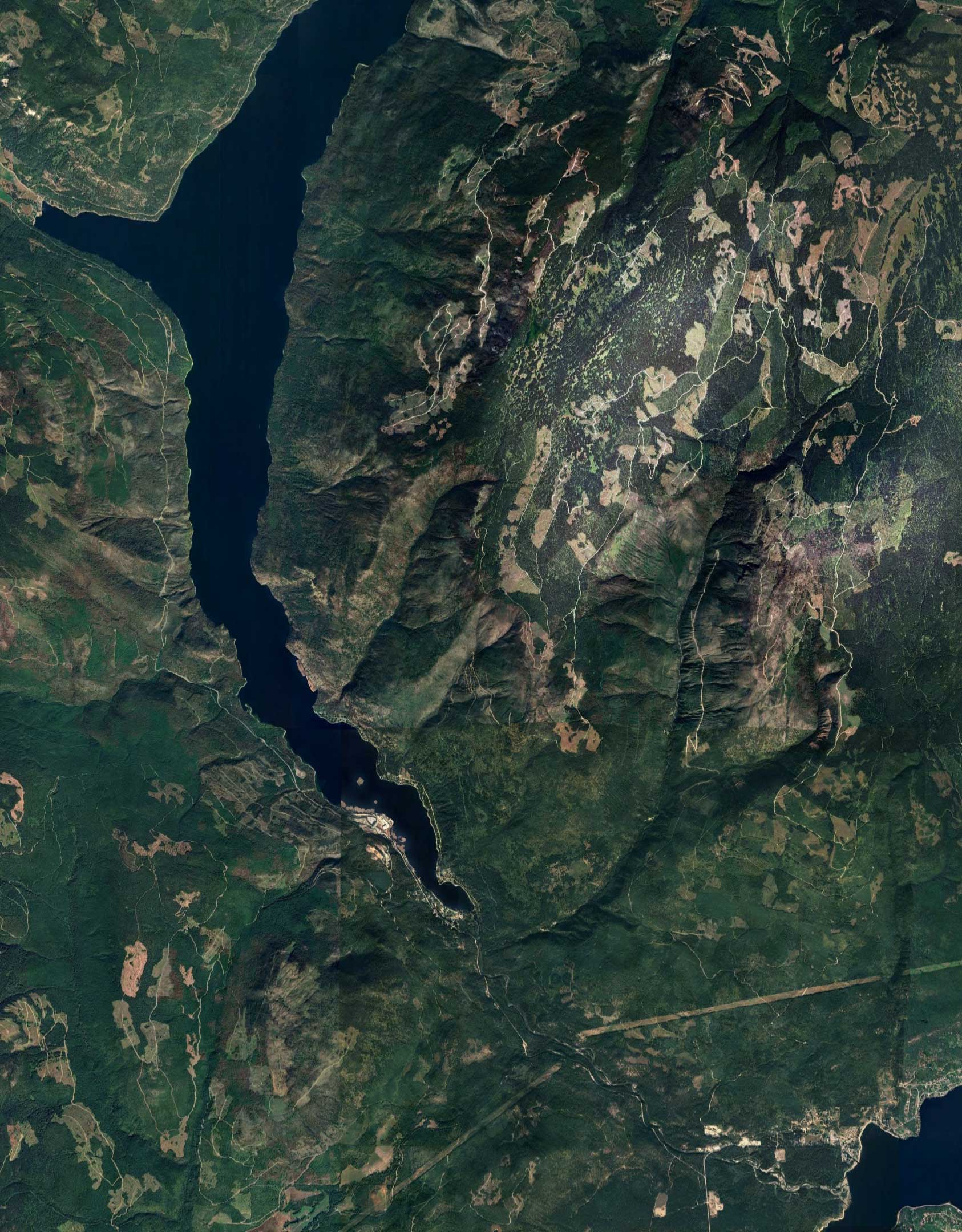
The Wilmac Property
The Wilmac Property is strategically located within one of British Columbia’s most active mining districts, offering both excellent infrastructure and strong exploration potential. Its proximity to Princeton and Copper Mountain Mine makes it highly attractive for future development.
16K
270
1.67
The Site
Geological Setting
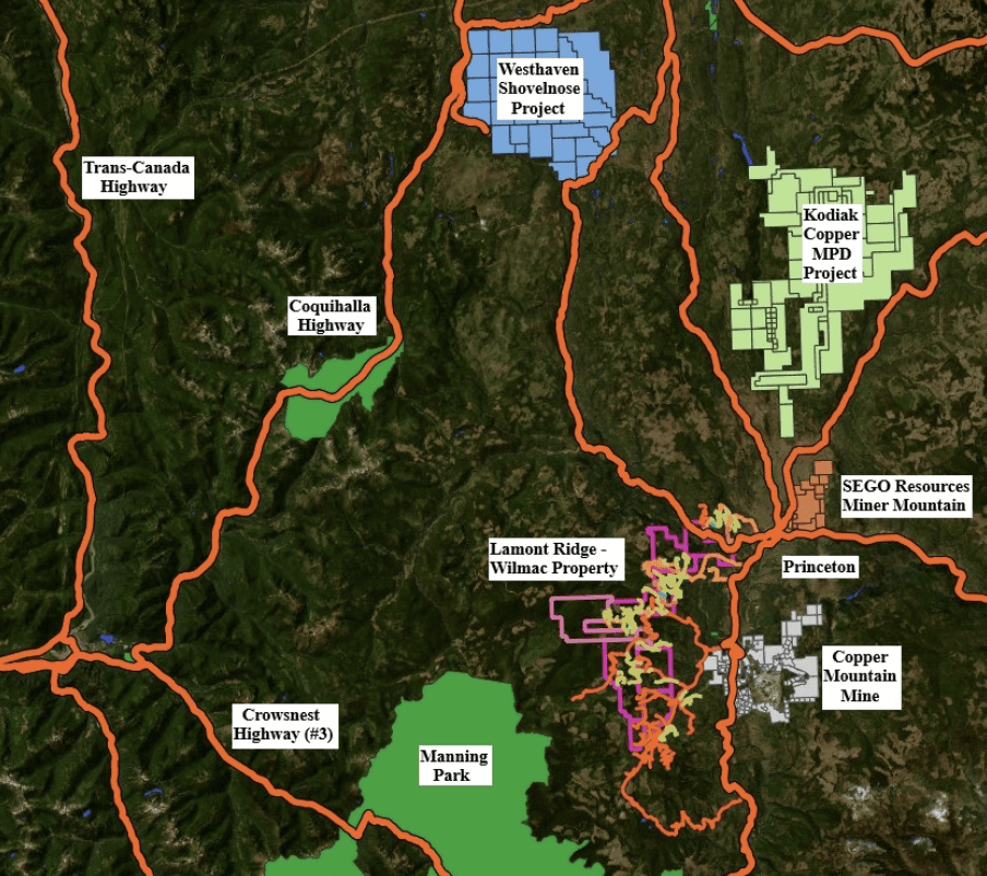
Site Potential
Mineralization Types Identified
Exploration to date has confirmed multiple locations having alteration and/or mineralization styles consistent with copper porphyry systems found across British Columbia. These occurrences demonstrate the property’s geological fertility and potential scale.
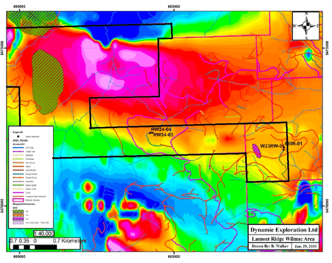
Recent Field Programs
Recent work has focused on confirming access, geological mapping, sub-surface IP/AMT geophysics and collecting samples (both rock and soil) to refine exploration targets. These activities continue to validate the property’s potential to host a copper-gold porphyry system.
Road network surveys → confirmed access to / within the property tenures
Acquisition of the “Plume” tenure approved (tenure 1131217, 2,063 ha / 5,098 acres)
Rock sampling campaigns → diorite, gabbro, pyroxenite & hornblendite exposures
Sampled previous trenching at Wilmac MINFILE → chalcopyrite + epidote alteration
2024: lab / pXRF analytical results 96 soil samples (received August 2025) → High copper values to 1,125 ppm
An additional 831 soil samples in 2025, analyzed using a Portable X-Ray Fluorescence (pXRF) analyzer; subsequent analysis by lab proposed – to include analysis for gold
Continued sampling of Lamont Ridge area proposed for 2026, analysis by pXRF
Partial IP / AMT geophysical survey on the Wilmac grid in 2025; complete in 2026
IP / AMT geophysical surveys of West Lamont, North Lamont and Plume proposed for 2026
Trojan – Condor Corridor tenures added (4,574 ha / 11,303 acres)
Evidence of Alkalic Cu-Au Porphyry system potential at multiple sites (Trojan – Condor Corridor, North Lamont, Lamont and Wilmac grids)
Lamont, Trojan-Condor Corridor and Wilmac → multiple drill ready targets
Drilling proposed in multiple areas upon receipt of approved Mines Act permit
Exploration has confirmed multiple locations having copper porphyry-style alteration and/or mineralization, highlighting the property’s strong geological potential.
Continue geochemical sampling (soil and rock), expand IP/AMT geophysical coverage → develop / define drill targets.
With respect to rock samples collected from the Wilmac trenches, samples were submitted to, and analyzed by, ALS Canada in North Vancouver. Samples were analyzed together with standards by the lab. Soil samples collected in 2025 from the North Lamont area were submitted to, and analyzed by, ALS Canada in North Vancouver. Samples were analyzed together with standards by the lab. Samples collected in 2025 from the Lamont Ridge road network were prepared and analyzed by the Qualified Person using a portable X-Ray Fluorescence analyzer. Samples were analyzed in batches of 20, with two standards and a blank after every sequence of 20 samples. A total of eight OREAS certified reference standards (OREAS 21f, 23b, 30a, 245, 502d, 503e, 507 and 508), representing a range in copper grade, primarily from copper porphyries, were used as standards and sequentially rotated through the analytical cycle in batches of 2. A Calibration blank was analyzed at the start of each day of analysis.
Exploration has confirmed multiple locations having copper porphyry-style alteration and/or mineralization, highlighting the property’s strong geological potential

